
Last Updated on February 27, 2025 by Afsar
Are you searching for the best kayak GPS device on the market? We’ve got you covered!
Whether you’re an avid kayaker or enjoy fishing from your kayak, having a reliable GPS can make all the difference. Imagine exploring a remote lake or heading to your favorite fishing spot only to find yourself lost or disoriented. This scenario can quickly turn into a nightmare without a dependable GPS to guide you back.
A kayak GPS is an essential tool for those venturing into unfamiliar waters or even revisiting known areas. It not only helps you navigate back home safely but also allows you to mark your favorite fishing spots so you can return to them effortlessly. Even if you’re familiar with your usual locations, bringing a kayak GPS ensures you’re prepared for any unexpected situations.
So, whether you’re charting new territories or simply want to make the most of your fishing trips, a kayak GPS is a must-have. Dive into our guide to find the best kayak GPS devices for 2024 and ensure every trip is a safe and successful one!
Disclaimer: This site contains affiliate links to products. We may receive a commission for purchases made through these links. However, this does not impact our reviews and comparisons. We try our best to keep things fair and balanced, in order to help you make the best choice for you.
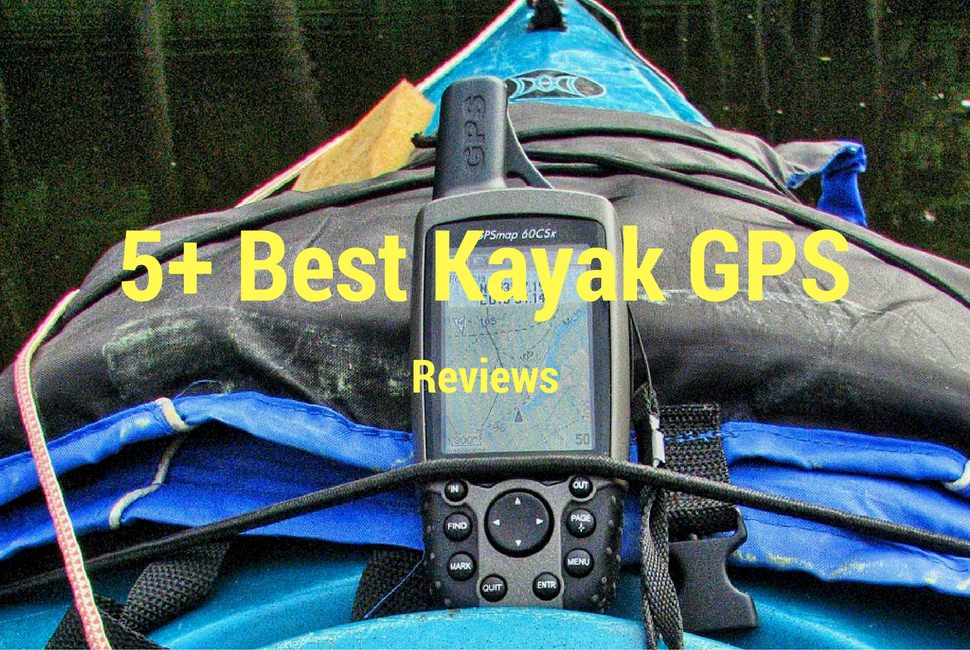
Best Kayak GPS 2025
Kayak GPS Review

Garmin eTrex 10
Worldwide Handheld GSP Navigator
Best Bang For Your Buck: Garmin eTrex 10 is the best cheap kayak GPS on the market. Garmin eTrex 10 is an incredible GPS navigator which comes at a very low price. For kayaking, you need a rugged and waterproof GPS device. Garmin eTrex 10 has a rugged body with a waterproof level of IPX7 standards. So it can withstand splashes, water drops, rains, etc.
There are several variations of this device, but the basic one is sufficient for more kayakers. The device comes with a 2.2-inch monochrome display and it is preloaded with a worldwide basemap. The device is a WAAS-enabled GPS receiver with HotFix & GLONASS support. Thus, the positioning is fast and the signal is good too. You can power up this device with two AA batteries for up to 20 hours of use. So, if you like small devices which are easy to manage, Garmin eTrex 10 is a fantastic GPS for kayaking for you.
Pros:
- Low price
- Rugged design
- Waterproof IPX7 standard
- WAAS enabled GPW with HotFix and GLONASS support
- Supports paperless geocaching
- Two AA batteries power it for up to 20 hours of use
- Compact design for easy operating and managing
Cons:
- small 2.2-inch display


Garmin inReach Explorer+
If you are exploring dangerous or remote areas and want to have interactive SOS from anywhere in the world, inReach Explorer+ is an excellent option for you. InReach Explorer+ can be used as a GPS, 2-way communicator, and emergency beacon. A 100% global Iridium satellite coverage will enable your device to have two-way text messaging from anywhere. However, to use the Iridium satellite coverage, you will have to buy a satellite subscription. In case of an emergency, you can use your inReach device to trigger an SOS to the 24/7 search and rescue monitoring center.
The device allows you to track and share your location with friends and family. It comes with preloaded Delorme TOPO maps, onscreen GPS routing, a built-in digital compass, a barometric altimeter, and more features. You can pair it with mobile devices using the free Earthmate app, which offers access to downloadable maps, U.S. NOAA charts, color aerial imagery, and more. The optional inReach weather forecast service allows the users to get detailed updates directly on their devices. It helps you to prepare for the trip.
Pros:
- Satellite communicator and GPS navigator
- 100% global iridium satellite coverage
- Two-way text messaging
- Interactive SOS can be triggered to 24/7 search and rescue monitoring center
- Can be paired with mobile devices using the free Earthmate app
- Preloaded DeLorme TOPO maps
- Track and share your location with family/friends
- Weather forecast
Cons:
- Expensive


Garmin Oregon 600
Best GPS For kayaking: Garmin Oregon 600 is a worldwide handheld GPS with 3-inch sunlight-readable display. This little GPS device has touchscreen functionality with multi-touch capability. You can take this device to kayak through the mountains or heavily treed areas, and it will still provide great support. By the utilization of both GPS and GLONASS, this device has a very good reception ability. It is also WAAS compatible. One of the coolest things about this device is very easy to maintain and understand.
You can share routes, tracks, waypoints, or geocaches with the ANT or Bluetooth technology. You can switch between portrait or landscape views for easy reading. Three sensors are used on this device: 3-axis compass, accelerometer, barometric altimeter. For battery purposes, you can use either the rechargeable NiMH pack (which you need to purchase separately) or the traditional AA batteries. This GPS device is packed with lots of features like the BaseCamp, where you can plan your trip by creating Garmin Adventures to share with your buddies.
Pros:
- Easy to maintain and operate
- Dual-band GPS/GLONASS satellite positioning for better reception
- Share waypoints, routes, tracks, custom maps, and more with Bluetooth
- Dual battery system: NiMH battery pack (bought separately) or traditional 2AA batteries
- Different sensors
- Easy to add maps
- Easily load Geocaches
Cons:
- Water drops might cause trouble to touch sensitivity. However, a few drops didn’t cause trouble for me
- Display is small

Garmin Montana 680 GPS
Garmin Montana 650 is a famous GPS device for outdoor explorers. If you can remember, the Montana 600 was hugely popular, and the Montana 650 kept all the features and improved them for better performance. You get a lot of map overlay options to easily get the necessary information. Like a good GPS device, it allows you to share waypoints and images with other compatible Garmin devices. Since the kayakers are close to the water, Montana 650’s shock and water-resistant bodies are very beneficial for us.
Garmin Montana 650 comes with a 4-inch color screen. The backlit color screen can be easily seen day and night. It’s small enough to manage easily and big enough to see the data quickly. There are lots of other advanced features like it can be loaded with TOPO 100k maps, bluechart marine maps, CityNavigator maps, etc. You can even use the MicroSD card port to use custom maps. What’s more, you can download geocaching.GPX file for accessing more hidden caches. Please note that for using different Maps, you may have to buy them separately.
In my opinion, Garmin Montana 650 is the best kayak GPS you can find on the market. I completely love the features and rugged body of Montana 650 GPS.
Pros:
- 4-inch perfect display for kayak GPS
- the color display can be seen in sunlight or in the night
- Share waypoints
- Preload 250,000 worldwide geocaches from geocaching.com
- GPS and GLONASS
- WASS enabled receiver
- Quickly and easily locates your precise position
- Organize and navigate through the waypoints, routes, and tracklogs
- Can be loaded with TOPO 100K maps, BlueChart marine apps, custom maps via MicroSD card (You may have to buy Maps separately)
- GPS and HotFix technology even detects you when kayaking in remote and heavy tree zones
Cons:
- The camera isn’t that great
- Display resolution could be better

Garmin GPSMAP 78
(2.6 inch Marine GPS Navigator and Worldwide Chartplotter)
This is a small yet highly efficient marine GPS navigator at a very decent price tag. Garmin GPSMAP 78 comes with a small 2.6-inch display with easy-to-access keys. The TFT display has a 160×240 pixel resolution. Despite the small size, this GPS navigator came with a MicroSD card slot to load additional maps. The built-in worldwide basemap is very efficient, though. You can also use Garmin Connect to send your activities and send tracks to other outdoor devices.
Since we are talking about kayak GPS, it’s worth mentioning that this is waterproof to IPX7 standards. It even floats in the water. There are tons of other features like geocaching GPX files to download geocaches to deliver straight to the Garmin GPSMAP 78.
Pros:
- MicroSD Card Slot for additional maps
- Built-in basemap
- Garmin connects to share activities with outdoor devices
- Waterproof standard IPX7
- Floats on water
- Download geocaches
- Slim and lightweight compact design
- High portability
Cons:
- Small Display

Garmin eTrex 30x
Inspired by the Garmin eTrex 20x, this handheld GPS is upgraded with a better display and functional materials, including more maps and built-in sensors. Garmin eTrex 30x comes with an upgraded display, featuring 2.2 inches long screen with 65k color. It has a resolution of 240×320, and it is sun readable. The device comes with a whopping 3.7 GB of internal memory, and a microSD card slot that lets you load a variety of maps. You can try the TOPO 24K, HuntView, BlueChart g2, City Navigator NT, and BirdsEye Satellite Imagery (additional subscription necessary).
eTrex 30x comes with a worldwide basemap with shaded relief. eTrex 30 features a built0in03-axis tilt-compensated electronic compass with a barometric altimeter that tracks the changes in the pressure to pinpoint the exact altitude. If you want, you can use it to plot barometric pressure over time. You can wirelessly share your waypoints, tracks, routed, and geocaches with other compatible devices. Considering all of the features, I can tell that this is one of the best kayak GPS you can have at the moment.
Pros:
- 2.2 inches screen
- 65K color
- Sunlight readable
- 240×320 pixels
- 3.7 GB of memory
- microSD card slot to load more maps
- Preloaded basemap
- Built-in sensors
- Share your waypoints, tracks, routes with other compatible devices wirelessly
- Wirelessly connect with compatible Garmin devices, VIRB, and accessory sensors
Cons:
- The menu could be made a little bit easier to understand

Magellan eXplorist GC
Waterproof Geocaching GPS
Magellan eXplorist GV is a geocaching GPS with a 2.2-inch LCD display. The display can be seen in direct sunlight. The main functionality is that it can easily connect with the Geocaching.com user community. You can do various kinds of stuff like perform a “Send to GPS”, and create and sync pocket queries. The device is pre-loaded with the most popular geocaches in the world. The user interface is pretty easy to understand. The intuitive interface can be handled with simple controls and a menu. You can easily navigate the menu with rich graphics. The device is WAAS/EGNOS/MSAS supported.
You can download more than 20 unique characteristics of each cache and view, search, and filter on the device. Up to 10,000 geocaches can be stored on the device. The device is rugged and waterproof to IPX-7 standards. 2 AA batteries provide 18 hours of battery life to the Magellan eXplorist GC.
Pros:
- Compact design
- 2.2-inch LCD display
- Paperless Geocaching
- Easily connects with Geocaching.com user community
- An easy intuitive user interface
- Easy controls and menus
- Display readable in direct sunlight
- High-sensitivity SiRFstarIII GPS
- Waterproof standard IPX7 standards
- 2 AA batteries give 18 hours of usage time
- worldwide basemap
Cons:
- The screen is very small
- Reading in direct sunlight is not that easy
- Takes time to understand the system
- No manual was provided, had to read online
What is GPS?
GPS stands for Global Positioning System, and it is a network of satellites and receivers that can determine the precise location of a person, vehicle, or device on the Earth’s surface. The United States Department of Defense developed the GPS system and was originally designed for military use, but it is now widely available for civilian use. The GPS system works by using a network of satellites that orbit the Earth. These satellites transmit signals to GPS receivers on the ground, which can use those signals to calculate the receiver’s location, speed, and direction of movement.
A GPS receiver uses trilateration to determine its location. Trilateration is a mathematical technique that uses the distance between the receiver and three or more GPS satellites to calculate the receiver’s exact location. By using signals from more than three satellites, a GPS receiver can also determine its altitude and the time. GPS devices come in many forms, from handheld units to smartphone apps and car navigation systems. They can provide a variety of information, such as maps, directions, speed, distance, and even weather and traffic conditions.
In addition to civilian use, the GPS system is also used for scientific research, surveying, and emergency services. The system is used by airplanes, ships, and other vehicles to navigate and stay on course, and it has even been used to track wildlife and monitor the movement of tectonic plates. Overall, GPS is a powerful technology that has revolutionized the way we navigate and explore our world. It has made it easier for people to find their way, stay safe, and discover new places, and it has opened up new possibilities for scientific research and exploration.
Why Do You Need A Kayak GPS?
There are several reasons why you may need a GPS for kayaking. The main reason to get a GPS is safety. There are some portable fishfinders with GPS too. Instead of providing a brief, I am going to share the reasons in bullet points
- Navigation: One of the most important benefits of using a GPS device while kayaking is navigation. A GPS device can provide the kayaker with precise location data and help them navigate to their destination more accurately. This can be especially useful in areas with low visibility, such as fog or darkness, where it may be difficult to see landmarks or other navigational cues. Additionally, if a kayaker gets lost or disoriented, a GPS device can help them get back on track by providing direction and location data.
- Safety: A GPS device can also be used to help kayakers stay safe while on the water. By providing information about nearby hazards, such as rocks, reefs, or strong currents, a GPS device can help the kayaker avoid potentially dangerous situations. Additionally, some GPS devices can be used to mark the location of a campsite, a launch point, or other important landmarks, which can be helpful in case of an emergency.
- Record-keeping: Many GPS devices can track the kayaker’s route, speed, and distance traveled. This can be useful for keeping a log of kayaking trips, planning future trips, or sharing information with other kayakers. By tracking this data, kayakers can also monitor their progress and improve their performance over time.
- Emergency situations: In case of an emergency, a GPS device can be a lifesaver. By providing precise location data, a GPS device can help rescue crews locate the kayaker more quickly and accurately. This can be especially important in areas with limited cell phone coverage or if the kayaker is unable to communicate their location verbally.
Why Do We Prefer GPS System over Smartphone GPS?
Using a dedicated GPS system for kayaking is preferred over a smartphone GPS for several key reasons:
- Durability and Waterproofing: GPS devices are built for rugged conditions and are typically waterproof, making them more reliable for outdoor use.
- Battery Life: GPS units offer extended battery life, crucial for long trips, whereas smartphones drain quickly.
- Signal Reliability: GPS units have better signal reception in remote areas, where smartphones may struggle.
- Navigation Features: GPS devices provide specialized, detailed navigation features and preloaded maps tailored for outdoor activities.
- Usability: GPS systems are designed for easy use in outdoor settings with larger, glove-friendly interfaces.
- Dedicated Purpose: GPS units are focused solely on navigation, ensuring no interruptions from other apps or notifications.
In short, dedicated GPS systems offer greater reliability, durability, and functionality for outdoor adventures like kayaking.
How can a GPS device help me navigate while kayaking?
A GPS device can be very helpful for navigation while kayaking, as it can provide you with precise location data and help you find your way to your intended destination. Here are some ways in which a GPS device can help you navigate while kayaking:
- Precise location data: A GPS device can tell you exactly where you are on the water, even if you can’t see any landmarks or other navigational cues. This can be especially helpful in areas with low visibility, such as fog or darkness.
- Mapping: Many GPS devices come with pre-loaded maps or the ability to upload maps, so you can see your position on a map and navigate to specific points of interest, such as campsites, landmarks, or fishing spots.
- Waypoints: A GPS device can allow you to mark specific locations, or “waypoints,” that you want to navigate to, such as the location of a campsite or a good fishing spot. You can then follow the GPS device’s directions to navigate to those waypoints.
- Tracks: Many GPS devices allow you to record your route as you kayak, creating a “track” that you can use to follow your path back to your starting point or to review your route later.
- Direction and distance: A GPS device can provide you with information about your direction and distance from a specific location or waypoint, helping you stay on track as you kayak.
Overall, a GPS device can provide valuable information to help you navigate more accurately and confidently while kayaking. Whether you’re exploring new waterways or following a specific route, a GPS device can be a helpful tool to have on board.
Which Garmin is best for kayaking?
Garmin inReach Explorer+ is one of the best Garmin GPS devices for kayaking. It comes with tons of cool features and has IPX7 waterproof rating. You can add preloaded Delorme topo maps use the barometric altimeter, accelerometer, and more to make a better decision. However, this Garmin device is a little bit expensive. If you don’t want to break the bank, buying Garmin eTrex 10 is better. I suggest this Garmin kayak GPS if you want to save money but don’t want to sacrifice any necessary features.
How to Choose the Best GPS for Kayaking?
Choosing the best Kayak GPS for your next journey is easy and simple to do. Kayaking or Fishing is different than hiking or other ground activities. You need a rugged GPS device for kayaking or fishing that can face tough marine environments. In that way, it will be very beneficial to you. Before landing the best handheld GPF for fishing or kayaking, there are some factors to look to.
Durability
Durability is one of the most important issues when choosing a GPS device. Most of the previously designed GPS devices had poor materials, which could easily break down. Nowadays, manufacturers are offering metallic finishes to GPS devices to improve durability. These devices are stronger than ever and offer impact resistance.
Since we kayak on the water, a good kayak GPS device needs to be waterproof. When we fish, we are close to the water; thus, a waterproof device is better. You can also use screen protectors and a waterproof casing to prevent water from getting into a regular GPS device.
Battery
As I have mentioned earlier, a good kayak GPS device will always come with excellent battery support. Assume you are exploring a new place, and suddenly, your smartphone or GPS device shuts down. You don’t know the place; you don’t know how to get back and are stuck there for an uncertain time. It sucks, right?
This is why you must choose a GPS device with enough juice to provide direction for a long time. We have mentioned some kayak GPS devices with better batteries. Besides the more extended battery, it needs to be easily rechargeable and has a fast recharging time. Things to consider when buying a kayak GPS system are:
- Lithium batteries tend to offer better battery life
- Inbuilt batteries to make it portable
- For the economic purpose, rechargeable batteries are better
Coverage and Reception
The main reason for getting a GPS device is to receive satellite data. Most GPS devices use WAAS (Wide Augmentation System) receiver to locate the route, landmarks, coastline while on the water, etc. Your kayak GPS needs to have fast reception because you might be using a trolling motor for high speed. A good kayak GPS device will also receive data on a very dense forest. I am not suggesting you go to the forest, but a lot of kayakers go. There might be other systems, but the point is that the GPS device needs to have better reception and more coverage of places.
Display
You will find different GPS devices with different display sizes. The resolution will vary on the device. A good resolution will allow you to see data more clearly. A kayak GPS might be between 2.2 inches and 5.7 inches. A small screen would be hard to read, while a big-screen GPS device would be hard to carry. My suggestion is to choose a GPS device from 3.5 inches to 4 inches. Thus, you get to see the data more easily and quickly.
Ease of Use
A GPS device should be easy to control and read. I tried to mention the ones with easy reading and mapping. Not everyone is tech-savvy, and that’s totally ok. You need a device that requires less time to understand the readings.
Final Verdict
Let’s acknowledge that no matter whether we are professional or just noob explorers, we get lost at sometimes at some of our kayaking trips. This is why grabbing the best kayak GPS for your next endeavor is wise. My suggestion is to get the Garmin Oregon 600. I have personally used the Garmin Oregon 600 for a lot of my outdoor activities, and I am perfectly happy with it. For fishing purposes, Garmin Montana 680 is my favorite for taking pictures. However, if you are low on budget, you should grab the Garmin eTrex 10. I have used Garmin eTrex 10 for a few of my kayaking trips, and it delivered what it promised. If you have any suggestions or opinions regarding kayak GPS, you can leave them in the comments section below. I hope this great kayak GPS device will help you to improve your next journey. Happy kayaking.

Afsar is an avid kayak blogger born near the coast. He has a passion for kayaking and started as a child. He has paddled in various conditions and locations and promotes responsible kayaking. Afsar’s blog is widely read, and they are a respected voice in the kayaking community, offering valuable content on kayaking trips, gear, tips, and tricks. Afsar collaborates with other bloggers and brands and continues to inspire others through their writing and social media.