Last Updated on November 13, 2022 by Afsar
Not everyone enjoys paddling a kayak on calm water. Some people are more adventurous than others. Some people are born to fight in the wild, explore the beauty of nature, and go on adventures. Numerous kayakers love to paddle on rivers. Kayaking on the river is way more fun and adventurous than paddling on lakes. The United States is big, and many rivers are ready for kayaking.
Life is short, but you need to have maximum fun in this short span of life. When you grow old, you will look back and say you have lived a hell of a life. Let’s grab the best kayak or canoe and explore the beauty of nature. Kayaking in the river can be challenging, enjoyable, and fun. Every river has its own rules which you need to abide by. Each river ranges a difficulty from Class I to Class VI rapids. You need to figure out whether you are looking for a regular sightseeing journey or an adventurer and prepare for it. Class I means your grandma can kayak, while class VI represents the roughest one.
Table of Contents
Important Note:
- Always wear PFD (best inflatable jackets)
- Know what you are doing
- Get the best kayak, or canoe for the adventure
- If you are taking trips, then fuel up your wallet
- Leave your wallets and car keys at the check post
Top 10 Best Rivers For Kayaking In the United States
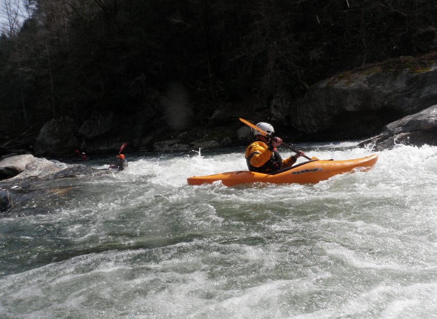
#1. Chattooga River, South Carolina/Georgia
Class ranges: III to IV in different sections
The Chattooga River is a whitewater river that runs through the states of South Carolina and Georgia. It’s one of the best kayaking rivers in the Southeast, with rapids ranging from Class II to Class IV+ (the highest level of whitewater).
The Chattooga’s whitewater is best at high water levels (March through May) when water levels are at their peak during spring rains. You can kayak the Chattooga year-round, but you should be cautious during low-water months (September through December), especially after heavy rainfalls.
Can you kayak the Chattooga River?
Yes, but it’s not easy. The river is one of the most popular whitewater runs in the country, drawing thousands of paddlers every summer. But it’s also one of the most challenging, with rapids that can leave even experienced paddlers battered and bruised.
The Chattooga River is a classic whitewater river that flows through Georgia and South Carolina. The entire length of the river is a Class II+ to Class IV rapids, with many sections of class III rapids.
The Chattooga is best suited for experienced paddlers with advanced skills who know how to handle class IV rapids. If you’re new to kayaking or want to learn more about this famous Georgia river, read on for tips on paddling safely on this wild waterway.
This stunning river’s unique history makes it one of the most popular destinations for paddlers in the Southeast United States. Man has used it for thousands of years as a source of water and food, and now it’s also being used by kayakers.
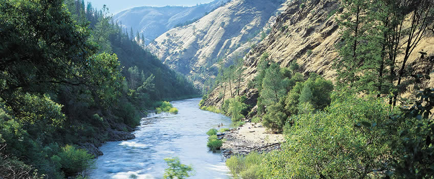
#2. Tuolumne River
Class ranges: IV-V+
Tuolumne River is a river in Yosemite National Park, United States. It is a tributary of the Merced River. With a 63-mile length, it is the longest river in Yosemite National Park (101 km). It begins at the foot of Lembert Dome in the High Sierra and flows down through a deep canyon to the San Joaquin Valley. The river is fed by melting snow and ice from the Sierra Nevada, which makes it a Class V+ whitewater run during the springtime.
The Tuolumne is formed by the confluence of its North Fork and Middle Fork near Don Pedro Reservoir. The North Fork begins at Triple Divide Peak, while the Middle Fork begins at Mount Dana; both are on the Sierra Crest.
The North Fork flows east through a deep canyon to join with the Middle Fork, then flows south past Crane Flat to join with the South Fork. The South Fork begins as a small creek on Lembert Dome and flows westward toward Glen Aulin before turning northward toward May Lake; it joins with the combined waters of the North and Middle Forks just south of the park boundary.
From there, the Tuolumne flows south through Tuolumne Meadows and past Olmsted Point, which Tenaya Creek from Lake Tenaya joins. The river then flows through Cathedral Lakes and down Cathedral Canyon, where it plunges over Waterwheel Falls (a popular hiking destination) into Little Yosemite Valley. Thereafter it drops into Hetch Hetchy Valley.
A journey down the Tuolumne River is excellent for whitewater rafting or kayaking in many ways. The river, which locals lovingly refer to as “The T,” is both challenging enough for the adventurous and tranquil enough to feel like a vacation. It’s in a gorgeous canyon in the foothills of California and has plenty of exciting, manageable Class III and IV rapids.
Depending on where you put in, there are different sections of rapids that you will encounter on this river, but there are several class V+ rapids that you should be prepared for if you plan on taking this trip.
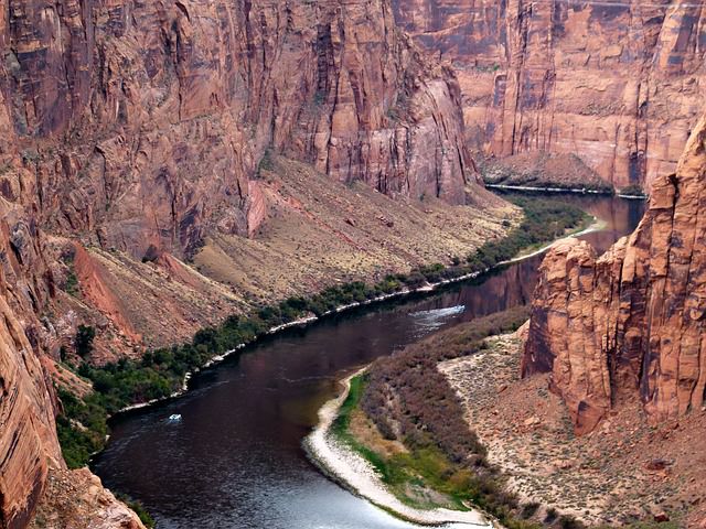
#3. Colorado River, Arizona
Class range: Class I-IV
Colorado River is a major tributary of the Grand Canyon. The river flows through a large portion of the Southwestern United States, and it drains an arid watershed of more than half a million square miles that encompasses parts of seven U.S. states and northern Mexico. The Colorado River system is vital to many southwestern Native American tribes, and it has been important for commerce in the Southwest since pre-Columbian times.
The headwaters of the Colorado River are 12,000 feet above sea level in Rocky Mountain National Park. It flows west to Dillon Reservoir, primarily in Summit County, Colorado; then south past Granby, Grand Lake, and Kremmling before entering Utah through Dinosaur National Monument. It then flows through Glen Canyon Dam near the town of Page and into Lake Powell just north of the city of Page.
The lower half of the Colorado River runs through Grand Canyon National Park, where it joins with its major tributaries: Paria River, Little Colorado River, and Virgin River, before exiting at Lake Mead near Las Vegas
Colorado river is one of the most popular rivers for kayaking. It flows through Grand Canyon National Park, and it is one of the longest rivers in Arizona. The Colorado river is one of the most scenic rivers in the world. It is so beautiful that it has been listed as a UNESCO World Heritage Site since 1981.
Colorado river has many rapids, waterfalls, and gorges along its banks, which make it an ideal place for kayaking. There are many places where you can rent a kayak and enjoy your time on the Colorado River at your own pace.
When is the best time to go kayaking in the Colorado River?
The best time to go on a kayak trip is during spring or summer when the water levels are high enough to paddle through rapids without getting stuck in them. If you want to go on a longer trip, you should go from April to October when there are fewer tourists and fewer rainfalls, making it more enjoyable for tourists.
I had a great time kayaking down the Colorado River. It was a fantastic experience. I saw a lot of things that I had never seen before, and it was very peaceful on the water. I also saw a lot of wildlife in the river and on the banks. The wildlife included a lot of birds, snakes, fish, and other animals that live near water sources.
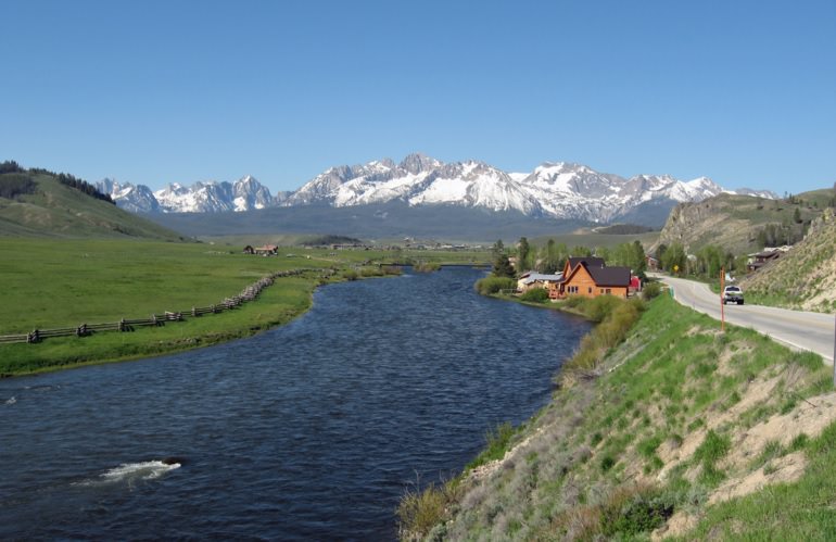
#4. Salmon River, Idaho
Sections: Middle Fork (Class III-IV), Main Salmon (Class III), Lower Salmon (Class III)
The Salmon River is a popular destination for kayakers from all over the world. The river is well-known for its Class III and IV rapids and its pristine wilderness landscape. This scenic paddle takes you through the heart of the Sawtooth Mountains and past some amazing waterfalls. The river is wide and slow-moving most of the way, with just enough rapids to provide some excitement without being dangerous.
But it’s also famous for being a favorite place for inexperienced kayakers to get in over their heads — which can be fatal. If you’re planning on kayaking the Salmon River, you need to know what you’re getting into and what precautions you should take before you go out there.
Salmon River Wildlife
The Salmon River is home to many different species of fish, including trout, steelhead, salmon, and catfish. The best time to fish is late summer, when the water temperature rises above 70 degrees Fahrenheit during the day and cooler at night (50-60 degrees). The Salmon River is known for its large brown trout up to 20 inches long, but there are also lots of smaller trout and smaller catfish that average about 12 inches long.
Camping in Salmon River, Idaho
The camping along this section of river is some of the best in Idaho, and there are several campgrounds along this stretch where you can camp for free (or for very little money).
Renting kayak in Salmon River, Idaho
You can take a guided tour or rent your own equipment and explore at your leisure. Several different companies offer rental equipment and guided tours for all skill levels, including beginner and expert kayakers. The best part about renting is that it allows you to customize your trip based on how much time you want to spend on the water and what level of difficulty you want (creek vs. river). Check Blackadar Boating & Salman River Kayak Rental.
Close cities: Stanley, Clayton, Salmon, Riggins & white bird.
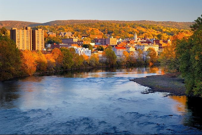
#5. Youghiogheny River
Class: II-V
The Youghiogheny River is a tributary of the Monongahela River, approximately long, in southwestern Pennsylvania in the United States. It drains a rugged hill country area of the Allegheny Mountains west of Pittsburgh.
The name “Yough” comes from a Lenape term meaning “a stream flowing in a contrary direction.” The word “yock” refers to the sound made by plants when they grow underwater. This place’s name was first recorded on 18th-century maps as Yoeghin.
The Youghiogheny River rises in southwestern Pennsylvania, in Fayette County. The river flows through what was once the heart of western Pennsylvania’s coal mining industry; it is now largely within the boundaries of Ohiopyle State Park. The watershed includes more than 100 miles (160 km) of streams and rivers that flow into either the Youghiogheny or Monongahela rivers.
Rapid Classification of Youghiogheny River
The Youghiogheny is a Class II whitewater river from the town of Ohiopyle to the confluence with the Conemaugh River in Cresson, Pennsylvania. Between Ohiopyle and Confluence, it is a class I-II river with many rapids but no major named drops (the “Yough” means “bad”). The United States Geological Survey has a gauge near Ohiopyle that shows an average flow. Below Ohiopyle, boaters enjoy Class I-II whitewater conditions through most of the rest of its course until reaching Cresson, where they can experience Class III rapids up to in difficulty before entering into Class I water again as they approach their destination at West Newton.
My Experience in Youghiogheny River
I loved the Youghiogheny River because it’s a great place to get away from it all, especially if you are not familiar with kayaking. I started my journey in Ohiopyle State Park and paddled down the river until I reached the confluence, where the Youghiogheny River meets the Monongahela River. Then I turned around and went back upriver to where I started. The trip took me about 5.5 hours total, with stops along the way. However, I was paddling very slowly as I was enjoying the scenario.
Youghiogheny River has many different types of rapids that are fun to run, depending on your skill level. There are also several places where you can stop along the shoreline for a break or snack break!

#6. The Everglades, Florida
The Everglades is a natural region in the southern portion of Florida. Every year thousands of people come to this place for kayaking, canoeing, and sightseeing. From landscapes to beautiful rivers this place is a heaven for outdoor lovers. No matter whether you love a peaceful or thrilling adventure, it has got everything for you.
You can choose several river spots or via the guides to find the perfect place for you. In a nutshell, this will be one of the best paddle journeys you will remember till your last day. Beautiful birds and sea creatures will entertain you on your paddling journey.

#7. Gauley River
Class range: IV-V
The Gauley River is one of the most beautiful rivers in West Virginia. This pristine river has a waterfall and lots of rapids, making it an excellent spot for rafting. The river is located in the Northern part of West Virginia near Summersville. The area around the river has lush vegetation, brilliant green trees, and lots of wildlife to see. Several hiking trails take you right up close to the Gauley River Falls and the nearby waterfalls.
The Gauley River is a National Historic Landmark, not just for its beauty but for the bravery of the men who first navigated it. It’s no ordinary river. It’s unlike any other you have probably ever seen. The result of an incredible natural event – a massive landslide that occurred thousands of years ago – the Gauley River is one of the most thrilling and breathtaking destinations in all of Appalachia.
The Gauley River is a beautiful and challenging whitewater rafting river that’s located in the state of West Virginia. It offers one of the steepest drops of any river open to the public, making it a challenging yet rewarding trip.
If you are looking for an excellent opportunity to test your skills while having a blast, you should visit the Gauley River. Gauley River is situated in West Virginia. This famous whitewater kayaking river is 105 miles long and merges with several rivers on its way through. Many paddlers come to this river for whitewater paddling, offering a great scenic view besides the paddling experience. It’s famous for rafting purposes though recreational boaters love to take any chance to hop in this river.
Seven reasons why you should visit Gauley river:
- The Gauley River Falls is one of the most beautiful waterfalls
- There are lots of exciting rapids on the river
- It’s a great place for an adventure vacation
- You can go hiking along the trails near the river
- You get to see lots of lush vegetation and brilliant green trees
- There’s a ziplining adventure that you can enjoy while you’re there
- The river has a rich history, which you’ll learn more about while visiting
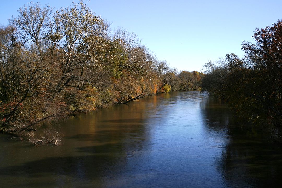
#8 French Broad River
The French Broad River is the largest river in the area, with a length of 110 miles. The French Broad River flows through Western North Carolina’s Appalachian Mountains. The waterway starts in the mountains of North Carolina and ends at the confluence with the Holston River near Knoxville, Tennessee. It is a designated National Scenic River and flows through the Pisgah National Forest. The French Broad flows through several cities and counties in Western North Carolina, including Asheville and Hendersonville.
The French Broad River is a beautiful, scenic river for kayaking. It has great rapids, wildlife, and history. In Asheville, kayaking enthusiasts can head out on this waterway on Lake Julian Park or follow the French Broad River Walk downtown. The French Broad River is also one of North America’s most popular whitewater rafting destinations, so if you’re looking for an adrenaline rush, this is the place for you!
Where to launch your kayak in the French Broad River?
There are several different places where you can put in and take out your kayaks or canoes on the French Broad River:
1) Big Island Launch – Located off of Highway 70, about 12 miles from Brevard, NC. A parking area for vehicles and a picnic area for those wanting to spend more time on this stretch of the river are available. This launch point offers easy access for those that want to take their first trip downstream.
2) Little Island Launch – Located off Hwy 70, about 5 miles from Brevard, NC.
Where to rent a kayak in French Broad River?
French Broad River Adventures offers various services, including kayak rentals, canoe rentals, and guided tours.
Are there any guided kayaking trips in the French Broad river?
If you’re looking for a guided trip, we recommend checking out French Broad River Outfitters. They offer guided trips on the upper and lower sections of the French Broad River near Asheville.
#9 John Day River
The John Day River is a tributary of the Columbia River, flowing through the U.S. state of Oregon. It is named after Captain John Day, an English explorer who was one of the first Europeans to see it in 1788. The river’s drainage basin is over 6,000 square miles (16,000 km2) in the area and encompasses parts of eleven counties in eastern Oregon.
The river runs for about 294 miles from its source near Prairie City to its mouth at the Columbia River. The upper portion of the river is free-flowing, with few or no impoundments or diversions along its course.
Dams and other water management structures have heavily modified its lower course. Approximately two-thirds of the river’s length has been impounded for hydropower generation and irrigation purposes.
You’ve heard of the John Day River, but do you know what it’s like to kayak or canoe down it? This is a trip that will change your life. The John Day River is a gorgeous place to kayak or canoe. The river winds through the Blue Mountains and can be accessed by boat launch sites at the town of Dayville, located on the north side of the river.
Can you camp in the John Day river?
There are several different places for camping along the John Day River, including Rock Creek Campground in Arlington and Diamond Lake Resort.
What wildlife can be seen on the John Day river, Oregon?
Those who are adventurous enough to explore this beautiful area can expect to see many different types of wildlife, including deer, bears, bald eagles, elk, beavers, blue herons, and more! The beauty of the John Day River is unmatched by any other.
Where to rent kayaks in John Day River?
For guided tours visit this page.
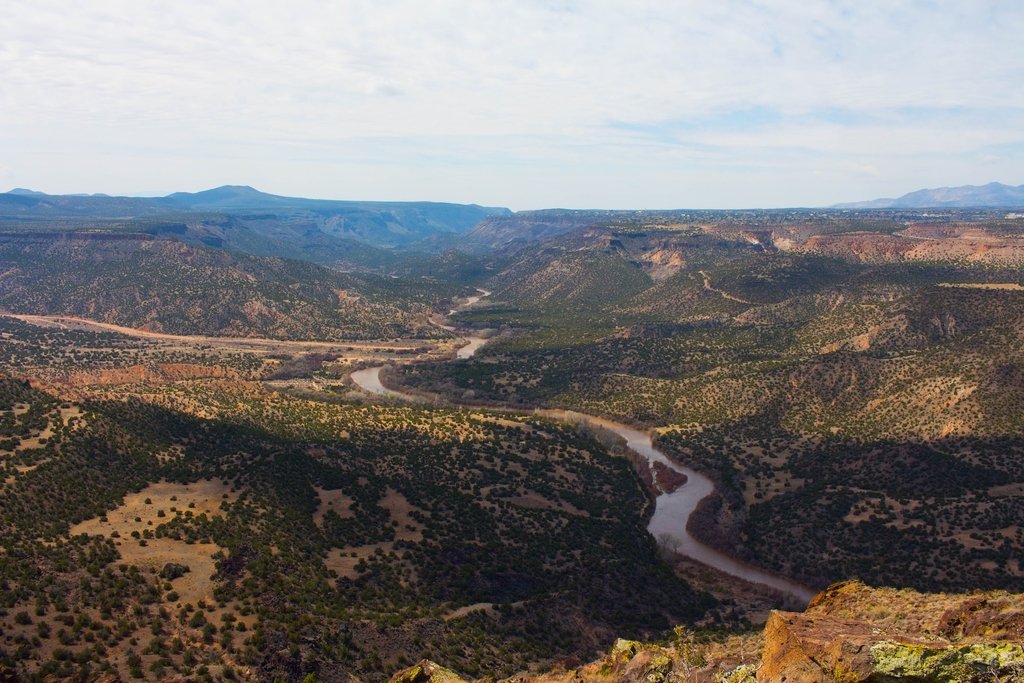
#10. Rio Grande River
The Rio Grande River is one of the most beautiful rivers in the world. It’s also one of the most important for nature lovers. The river was formed by melting glaciers over 15,000 years ago and has flowed ever since. Kayaking in the Rio Grande River is like a dream.
The water is cool and clear, and the air is crisp and clean. The river winds its way through canyon walls and over rocks, with white waterfalls dropping from every direction. Birds are singing, and you can see other kayakers on the water below you as you paddle along. You can also see ancient rock formations that have been carved out of solid rock by thousands of years of erosion. You get to see all of the natural beauty of the river, and you also get to imagine what it would be like to live in the area before modern civilization took over.
You just might find yourself feeling like you’re in paradise! The waterfalls that dot the landscape are truly breathtaking, and it’s impossible not to feel something while sitting on top of one. It’s hard not to get swept up in their beauty—and if you’re lucky, you might even see one of their inhabitants!
Wildlife of Rio Grande River
The water is crystal clear in this part of the river, so it’s possible to see fish swimming by as you paddle downstream. You might even spot some turtles sunning themselves on rocks or logs! You may also see wildlife like deer, wild turkeys, and even bald eagles!
Where to rent kayaks in the Rio Grande river?
Several outfitters rent out kayaks and equipment at reasonable prices, so you don’t need to worry about bringing anything but your own supplies (water bottles, snacks, etc.).
Shop:
- Kayaking in Arizona
- Interesting Kayaking books
- Kayaks for big guys
- Best Places to Kayak in Florida
- Kayaking in Colorado
- Kayak safety tips

Afsar is an avid kayak blogger born near the coast. He has a passion for kayaking and started as a child. He has paddled in various conditions and locations and promotes responsible kayaking. Afsar’s blog is widely read, and they are a respected voice in the kayaking community, offering valuable content on kayaking trips, gear, tips, and tricks. Afsar collaborates with other bloggers and brands and continues to inspire others through their writing and social media.

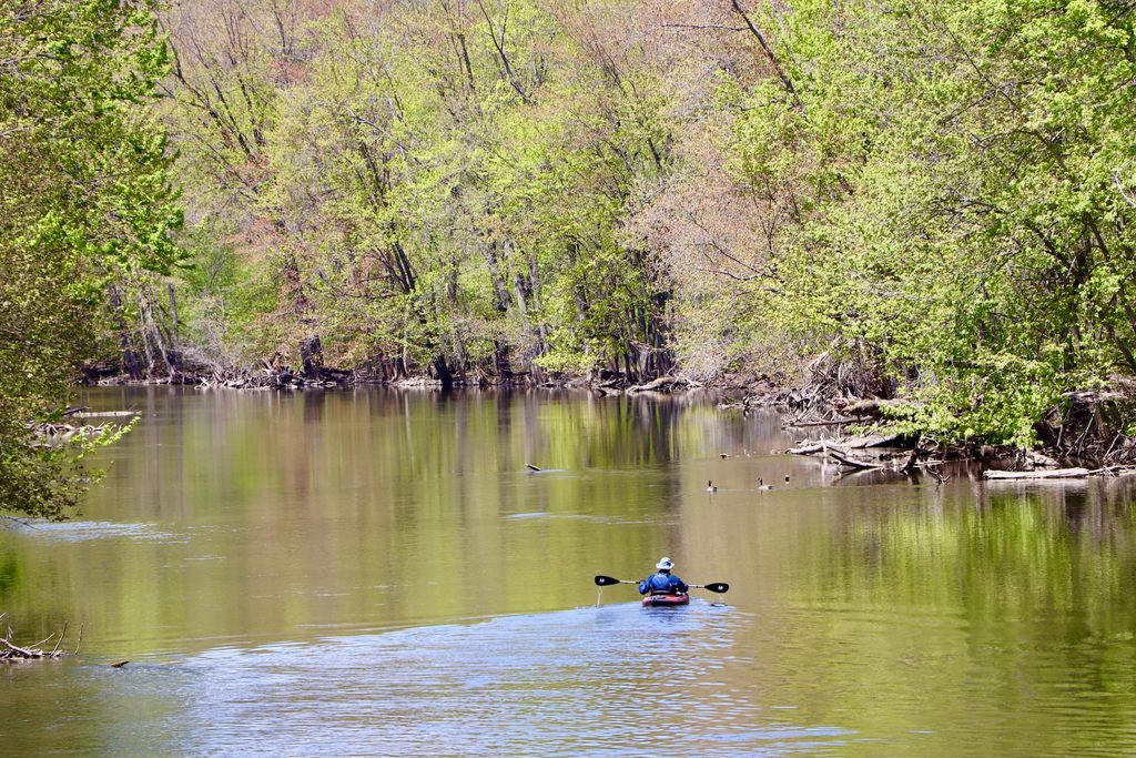
Comment if you have any “favorite river for kayaking” to be included in this post